
 English
 Español
 Deutsch
 日本語
日本語 Polska
 Français
 中國
中國 한국의
한국의 Українська
 Italiano
 Nederlands
 Türkçe
 Português
 Bahasa Indonesia
 Русский
 हिंदी
हिंदी
TopoExport Frankfurt-am-Main dxf dwg
Gratuit Modèle 3D
$0.00

- Formats disponibles:
Maya: ma 2.80 MB
- Animé:No
- Textures:No
- Installé:No
- Matériaux:
- Bas-poly:No
- Collection:No
- cartographie UVW:No
- Plugins Utilisé:No
- Prêt à imprimer:No
- 3D Balayage:No
- Contenu adulte:No
- PBR:No
- IA Formation:No
- Géométrie:Polygonal
- UVs non enveloppés:Unknown
- Vus:675
- Date: 2025-03-13
- ID de produit:562053
- Rating:
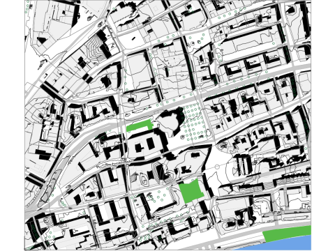
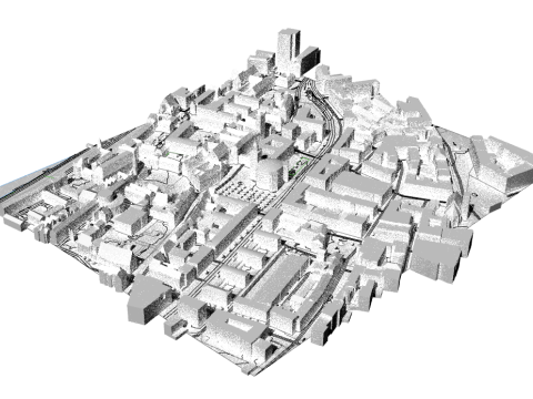
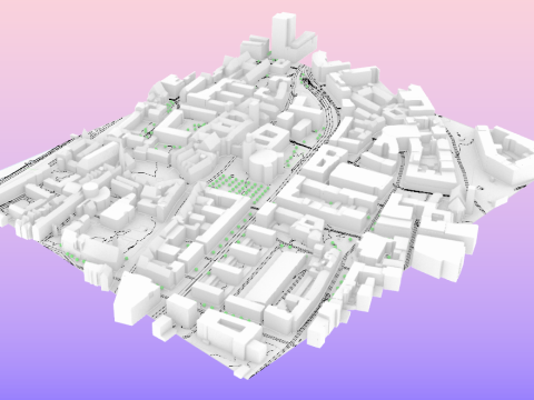
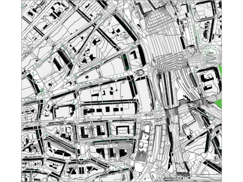
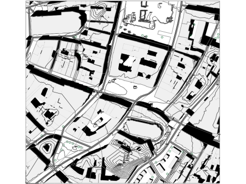
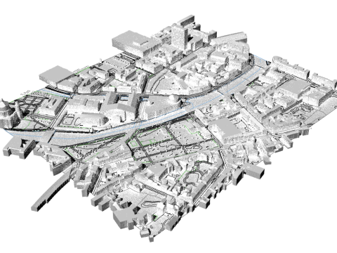
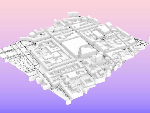
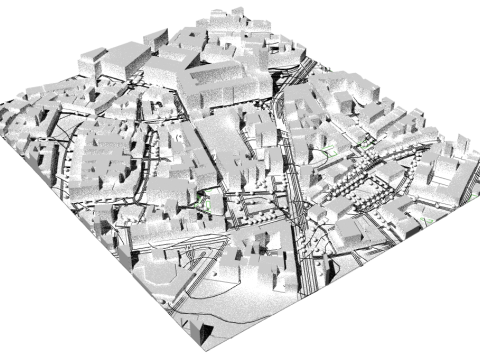
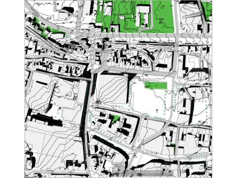
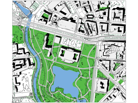
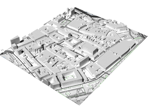
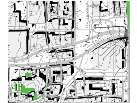
Frankfurt am Main.dwg topoexport.com Geodata description:
Frankfurt am Main Alkis: Buildings (2D) and parcels from Alkis, licensed under dl-de/by-2.0. (Data available at topoexport.com)
3D building model: Buildings in the LOD2 standard from the 3D building model LOD2, licensed under dl-de/by-2.0. (Data available at topoexport.com)
Frankfurt am Main DLM: Roads, railway lines, waterways, and tree canopy cover from DLM, licensed under dl-de/by-2.0.
Frankfurt am Main DGM1: Terrain model (DTM, 1 m) from DGM1, licensed under dl-de/by-2.0. (Data available at topoexport.com)
Nearby cities:
Offenbach am Main.dwg
Hauptwache.dwg
Sachsenhausen.dwg
Avez besoin de plus de formats?
Si vous avea besoin d’\autre format veuillez ouvrir un billet d’\assistance et demandez le. Nous pouvons convertir les modèles de 3D en: .stl, .c4d, .obj, .fbx, .ma/.mb, .3ds, .3dm, .dxf/.dwg, .max. .blend, .skp, .glb. Nous ne convertissons pas les scènes 3D et des formats tels que .step, .iges, .stp, .sldprt.!
Si vous avea besoin d’\autre format veuillez ouvrir un billet d’\assistance et demandez le. Nous pouvons convertir les modèles de 3D en: .stl, .c4d, .obj, .fbx, .ma/.mb, .3ds, .3dm, .dxf/.dwg, .max. .blend, .skp, .glb. Nous ne convertissons pas les scènes 3D et des formats tels que .step, .iges, .stp, .sldprt.!
Highly detailed geodata—perfect for urban planning or architectural projects in Frankfurt! Great that it’s fully accessible Visit this site and in multiple formats.